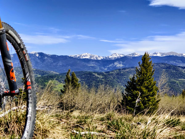

High-risk high-reward options for mountain biking in Taos County are vast.
by Jeans Pineda
There’s the classic South Boundary Trail. It’s registered by the International Mountain Bicycling Association as an EPIC (an iconic and adventurous backcountry trail). Shuttle Taos is a service that can help facilitate the logistics of dealing with a 20-plus-mile trail. The USFS-permitted shuttle service will drop you at one of two spots along the trail. Those wanting to tackle the whole length of the south boundary can be dropped off at Forest Road 76 in Angel Fire for a 21.5 mile ride back to their car. For a shorter ride back to your car you can get dropped off at Garcia for a 13 mile ride.
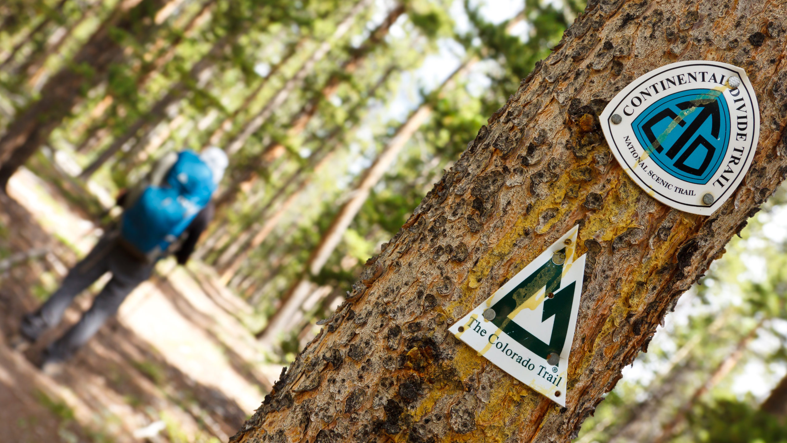
Seasoned mountain biking veterans needing a change of scenery can opt instead for Shuttle Taos’ new service, offering folks shuttles for those who want to ride, run or through-hike sections of the Continental Divide Trail. The section between Cumbres Pass and Echo Amphitheater is about 95 miles and has good access points every 20-25 miles.
The Carson National Forest Service offers, on their website, a list of mountain biking trails between the Camino Real Ranger District, Questa Ranger District, and the Tres Piedras Ranger District. While clear signage can sometimes be tricky out in the field, the CNFS provides detailed GeoPDF (an interactive map where you can obtain coordinates and 3D elevation, and track positions using a GPS device) maps for certain trails.
For those wanting a casual, easy going mountain biking experience, Taos can also offer relatively easy non-arduous trails. The easiest is the Rio Grande Gorge West Rim Trail. It’s only 3.7 miles and offers very little in the form of technical obstacles, but you’ve got the gorgeous backdrop of the Gorge Bridge and the Rio Grande. From the moment you get out of your car you have an opportunity of either making interesting conversation or purchasing a cool tchotchke, plush blanket or fine piece of jewelry from one of the vendors in the parking lot area. To make more of a day out of the short bike trail you can visit the nearby Earthship Biotecture only 2.1 miles away.
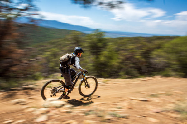
A mountain biker flies down South Boundary Trail in Carson National Forest outside of Taos on Sunday (August 15).
The Rift Valley Loop Trail is a lengthier (12-plus miles), more vigorous trail, but you don’t have to worry about steep drops or sharp switchbacks. You still get the benefit of gorgeous scenery around you as you would at the West Rim Trail. The Rift Valley is where the Rio Pueblo de Taos and the Rio Grande Converge. When the summer heat is at full throttle you can ride down the Slide Trail, which is more popular as a hiking trail but you can take your bike on it, and quickly get to a spot to dip your toes or soak your body in the river. On October 16, the Field Institute of Taos will host the annual free community event “Ride the Rift”. There will be a raffle, fun activities and free food. Proceeds go to the Taos Area High School Mountain Bike Team.
Once you’ve built up your confidence and your endurance you can try tackling the Green Chile Flow Trail which is “3.5 miles of buttery banked turns” at Taos Ski Valley. They designed the trail to be accessible to most skill levels.